Save Your Favorite Listings, Events, and Offers Here
Maps of Cape Cod

Click here to download a PDF of a large Cape Cod & Islands map.
All maps © copyright Cape Cod Chamber of Commerce. Maps may not be reproduced without permission of the Cape Cod Chamber of Commerce.
Cape Cod, Massachusetts is a 65-mile-long peninsula linked to the mainland by two bridges, the Sagamore Bridge and the Bourne Bridge, which span the Cape Cod Canal. Surrounded by water of all four sides, Cape Cod has 559.6 miles of magnificent coastal scenery and pristine beaches, along with more than 365 freshwater lakes and kettle ponds. Our travel maps are designed to facilitate your exploration of this beautiful corner of the world. The Cape is divided into four distinct regions: the Upper Cape, the Mid Cape, the Lower Cape and the Outer Cape.
CAPE COD MAPS
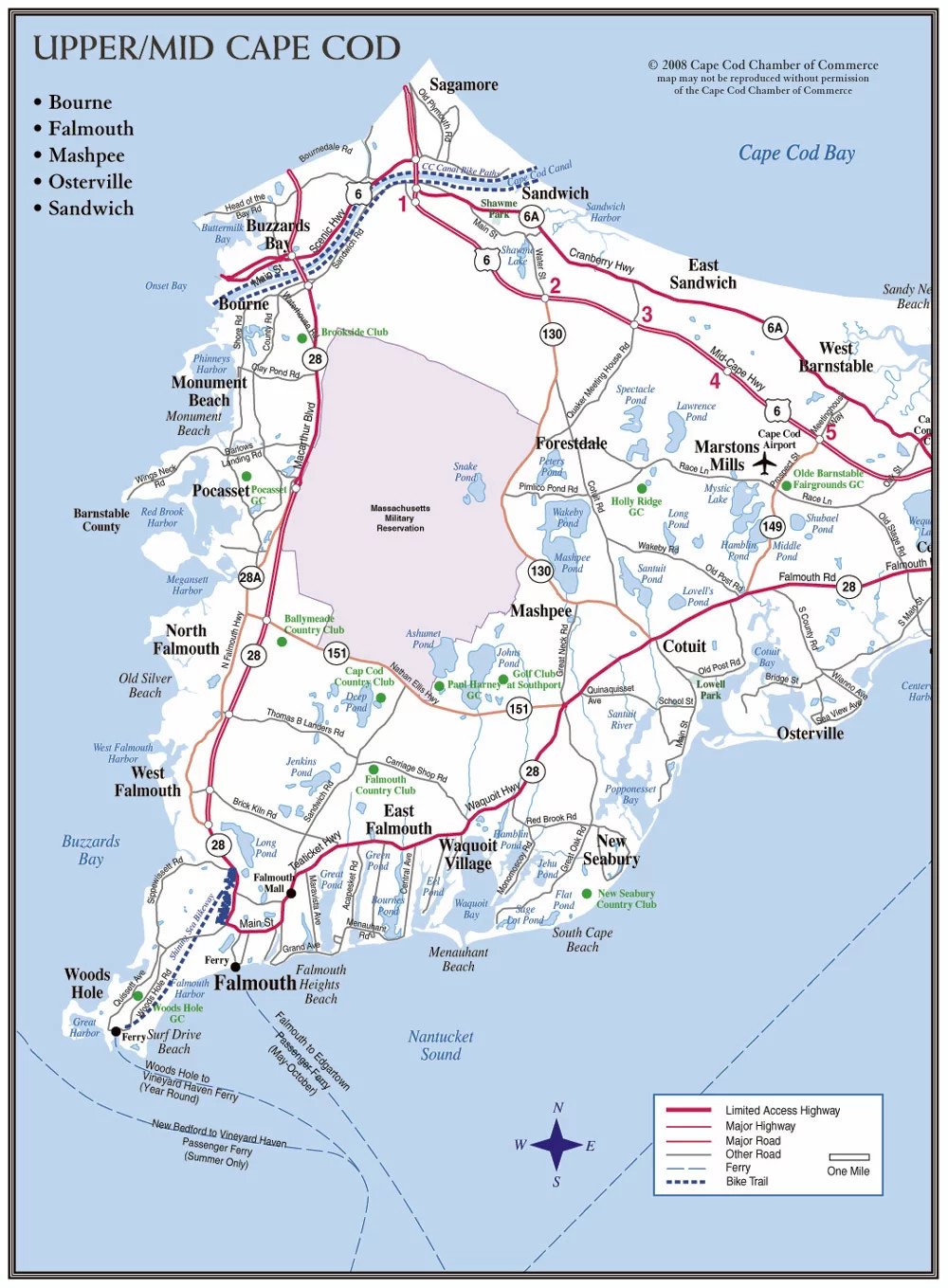
Click image to view entire Upper/Mid Cape Cod map

Click image to view entire Mid/Lower Cape Cod map
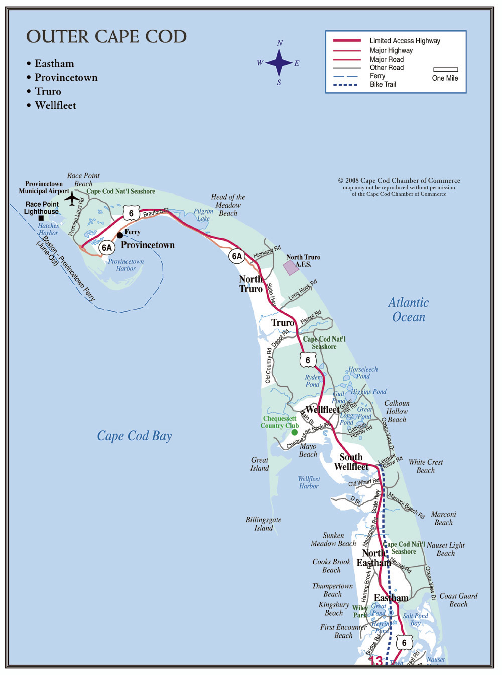
Click image to view entire Outer Cape Cod map
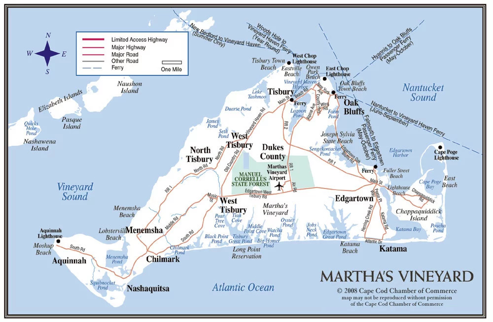
Click image to view entire Martha's Vineyard map

Click image to view entire Nantucket map

